3. How Hard is it to Interpret and Analyze Radar Data?

Knowledge Base  /  Interpreting & Analyzing Radar Data

3. How Hard is it to Interpret and Analyze Radar Data?

While interpreting radar images does take some skill, it doesn’t take a specialized degree or certification. Even hiring a dedicated radar image analyst is not necessarily needed. Organizations can effectively integrate radar analysis into their current workflow. After dedicating a few hours to learning the basics, radar novices can begin analyzing data and providing valuable intelligence to accomplish their missions. 

Learners have several resources available to help ease the cognitive load as they gain experience with radar interpretation:

  • Fine-resolution SAR imagery that’s easier to interpret than traditional radar images
  • Leading-edge radar products that incorporate automated processing to eliminate several interpretive steps
  • Software interfaces that display data intuitively
  • Training courses

Interpreting SAR Imagery

SAR images from different IMSAR data collections

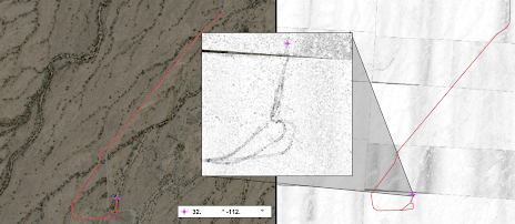
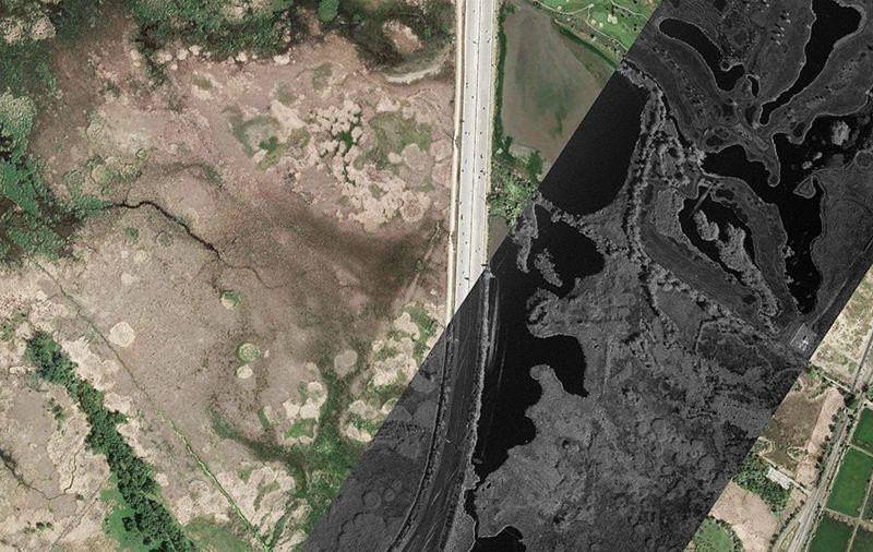
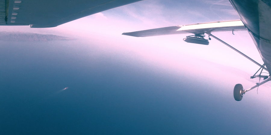
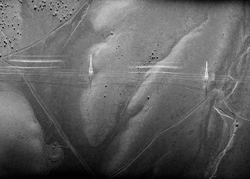
Radar images are non-literal, or in other words, they are a reconstruction of a scene, not a photo of one. While still useful, coarse or grainy radar images such as those above can create the perception that interpreting all radar data is complicated. However, fine-resolution SAR images make it easy to identify many common features and objects. In the image below, terrain, brush, and infrastructure are all easily discernible. Yet, some radar phenomena are at play in the image as well. For example, the bright outlines of the powerline towers in the image below are instances of a SAR phenomenon called layover, and do not accurately represent the dimensions and locations of the towers.  
SAR_ch3_Powerline

SAR image from an IMSAR data collect

Interpreting MTI and Other Advanced SAR Data Products

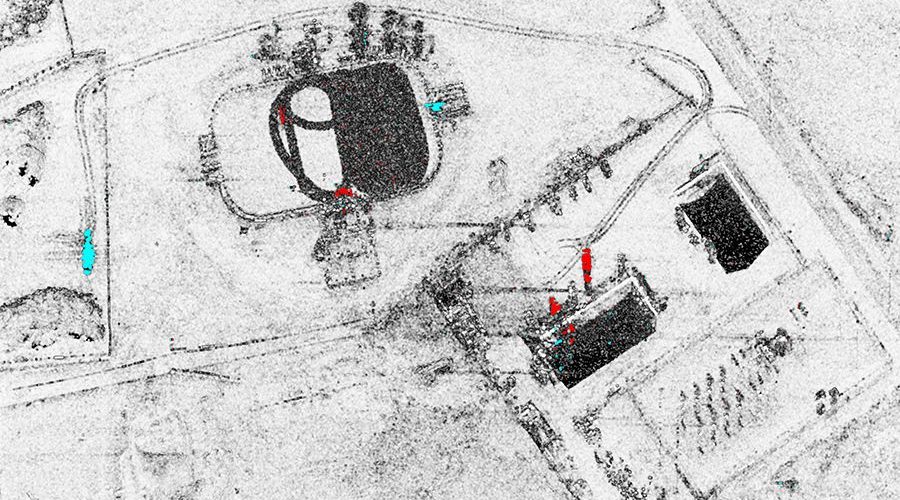
Through the multimode functionality of radar systems, some of the interpretation can be done automatically, so users are not flooded with data. Tools such as an MTI tracker and modes such as CCD/MCD process data automatically for specific uses. The resulting data products still need some basic explanations. For example, in the CCD/MCD data product shown below, data collected from two radar scans over the same area are combined to show changes between the two instances. CCD products display change as black highlights against an unchanged white background. MCD products display as “blue is new; red has fled” highlights, which is typical in change analysis.
ccd-1

CCD data product from an IMSAR radar data collection

Taking Advantage of Mission Management Software

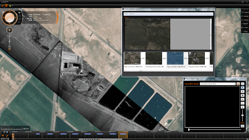
Robust mission management software reduces operator workload by displaying data not only from the radar, but also from a variety of other sensors, such as EO/IR, FMV, and AIS. Radar users have several software options from various vendors, each with their own advantages. Since we at IMSAR are only experts on our own software, we can only reference it in illustration of how software can ease the cognitive load. Complete IMSAR radar systems not only include the sensor, but also data processing servers and mission computers installed with IMSAR’s C2 and PED software, Lisa 3D. This graphical software displays the data from the sensor within seconds of collection. 
Lisa3d_ch3

A screenshot from Lisa 3D, IMSAR’s C2 and PED software

Getting Training

Although radar analysts do not need formal certification or a specialized degree in radar, IMSAR recommends some training in radar basics. If an organization already has personnel familiar with intelligence sensors and products, they are ideal candidates for radar training. Individual courses are available through various institutions online or face-to-face. Radar companies might offer training also. IMSAR offers a 5-day training course with each radar system purchase. During IMSAR’s training, attendees learn basics similar to those presented in this knowledge base. Additionally, they get hands-on experience interpreting radar data using IMSAR’s built-in software for imaging interpretation and analysis, Lisa 3D. 

IMSAR’s demonstration team manager explains how training resulted in practical application for one customer:

Contact us at sales@imsar.com for more information.


Related Content

Updated July 27th, 2021

2. Radar Enhances Situational Awareness

Knowledge Base  /  Radar Enhances Situational Awareness

2. Top 3 Ways Radar Enhances Situational Awareness

Decision makers involved in Intelligence, Surveillance, and Reconnaissance missions rely on relevant and timely data to gain situational awareness. Within their areas of responsibility, they seek to gain a tactical advantage over any situation, to ensure the safety of their personnel, and to decisively accomplish their objectives. Today’s multi-INT radars are masters at facilitating situational awareness, as exhibited in the following characteristics: 

  • Operating Environment: Intelligence gathering day or night, in DVEs, on land or sea
  • Multimode Capability: High-resolution imagery at great distances, rapid wide-area search, moving target detection and tracking, and change detection
  • Mission Application: Flexibility in combining modes for various CONOPS
NSP-7 on the King Air C90

IMSAR NSP-7 radar system integrated on a King Air C90

Operating Environment 

The quality of a radar image does not change with the weather or the time of day. Whether over land or in a maritime setting, radars meet the demands of any mission, providing actionable intelligence even through degraded visual environments, such as smoke, haze, or fog.

Example of FMV (Full Motion Video)
Example of SMV (SAR Motion Video)

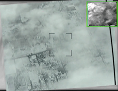
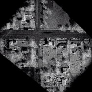
An FMV image (left) and an IMSAR SMV image (right) of the same intersection during the same conditions

Multimode Capability

With the ability to automatically process data into near real-time imagery or detection and tracking intelligence, SAR systems are capable, robust tools for ISR applications. They offer multiple modes that can be switched between rapidly with a few clicks of a mouse. The operator can use MTI to rapidly scan a large area, then key in on targets and switch to high resolution SAR imaging all on the same orbit or track. If multiple images have been collected (over land) on the same location, the operator can also switch to change detection imagery to see where the target may have moved to or traveled from. These capabilities combine to create powerhouse systems equipped to deliver exceptional situational awareness.

Data products from the multiple modes of IMSAR radars

Mission Application

Since today’s radars can produce data in multiple modes, users have considerable flexibility in switching and combining these modes to produce intelligent results for multiple military and commercial applications, such as counter-trafficking, maritime patrol, and route reconnaissance.

Mission CONOPs: For example, a combination of SAR imaging and CCD modes can be used to produce intelligent data for border protection or counter-drug or counter-trafficking missions.

Capitalizing on radar’s inherent capabilities gives ISR strategists a powerful tool for situational awareness. Contact us to learn more at sales@imsar.com


Related Content

Updated Mar. 22, 2021

1. When We Say Radar

Knowledge Base  /  When We Say Radar

1. What Does IMSAR Mean When We Say Radar?

RADAR: RAdio Detection And Ranging. Like laser, modem, scuba, and sonar, the acronym first used by the US Navy in 1940 has become such a common word that it’s no longer written in all caps. The definition of radar has come a long way from its initial application for military use during World War II to its current everyday applications from automotive safety to biomedical practice. Radar typically operates within the electromagnetic spectrum in frequency bands between 200 MHz to 36 GHz. As radar designers and manufacturers work to solve human challenges in several areas, radar has a myriad of sizes, shapes, levels of complexity, and applications within those bands. So, what does IMSAR mean when we say “radar”?

We Mean SAR  

Synthetic Aperture Radar is a radar that, through movement, electronically emulates a much larger antenna, resulting in finer resolution imagery through a much smaller radar. Typically, SAR systems are airborne and side-looking. They are designed to scan the earth’s surface, collecting high-resolution imagery and multiple other geospatial data products.

Additionally, inherent in radar is its ability to see in the dark and through degraded visual environments, such as smoke, clouds, and fog. With this advantage, SAR systems complement and work with other platform sensors, such as EO/IR cameras, for a true all-weather solution.

Cessna_MMTI_RadarInAction

IMSAR Radar System Performing Maritime Surveillance from the Wing of a Small Airborne Platform

We’re Talking Low SWaP

Historically, SAR systems have been relegated to satellites and large, specialized aircraft due to their size, weight, power and expense. When we say “SAR,” we’re talking about small size, weight, and power (SWaP) sensors for Group 1-5 unmanned and manned turboprop platforms. These smaller SAR systems incorporate the same advanced capabilities as the radar systems of the past, enabling a host of new aircraft to access the benefits that radar has to offer.

Today’s Airborne SAR Systems are Low-SWaP, as illustrated here with podded SAR systems mounted on the King Air B200, a turboprop-sized manned aircraft (left), and the Skyfront Perimeter 8, a Group 2 unmanned platform.

We’re Thinking Multimode 

The surface scanning and imaging ability of SAR systems allows for multiple interpretations of data through various radar modes. Standard radar system capabilities include SAR imaging, coherent change detection, and moving target indication modes.

SAR Imaging: Creates multiple high-resolution black-and-white images. The systems can perform both focused high-resolution imaging and coarse-resolution wide area searches.

CCD: Compares multiple SAR images of the same area collected at different times and automatically detects and highlights changes that occurred in that area between the data collections.

MTI: Performs rapid scans over a wide area, detects and tracks moving targets in real time, on land or on sea.

Furthermore, SAR is capable of performing more advanced modes such as Interferometric SAR (IFSAR), Inverse SAR (InSAR), Forward Looking SAR (FLOSAR), and Air-to-Air MTI (AMTI).

Examples of Radar Data Products (clockwise from upper left): SAR imaging, coherent change detection (CCD), maritime moving target indication (MMTI), and ground moving target indication (GMTI).

We’re Implying Multi-INT

Like pieces of a puzzle, when the multimode capabilities of SAR systems are intelligently combined, they provide a big-picture view to inform operational decisions. Synthetic Aperture Radar technologies are used for multiple military and commercial ISR applications:

  Counter Drug   Maritime Patrol   Search & Rescue
  Range Clearing   Convoy Overwatch   Route Clearance / Counter-IED
  Oil Spill Detection   Disaster Support   Illegal Fishing
  Ice Flow Monitoring   High Value Target Tracking   Battle Damage Assessment
  Border Patrol / Counter Trafficking   Force Protection   Forest Fire Detection 

We Plan to Democratize Radar

Radar, with its multitude of modes, capabilities, and unique benefits, is an important aspect of the overall approach to protecting Life, Liberty, and the Pursuit of Happiness. We seek to eliminate barriers that have prevented customers from looking to radar to augment or solve their ISR problems. We recognize that what we are able to do is only possible through the tremendous effort of all of those that have gone before us and all those that continue to push forward in the study and development of radar and other enabling technologies. At IMSAR, we seek to help democratize radar, making it more usable, affordable, and accessible. 

Ryan Smith, founder, president and CEO of IMSAR, and Larry Moore, executive vice president, further explain what it means to democratize radar.

If you would like to connect with us to learn more about radar, please contact us at sales@imsar.com.


Related Content

Updated Feb. 17, 2021