IMSAR systems provide multiple capabilities on manned or unmanned platforms.
The NanoSAR system solves multiple military and commercial needs including: regular route reconnaissance, persistent surveillance of an area of interest, encroachment detection, utility monitoring, and patterns-of-life analysis. The system increases operator effectiveness and expands area coverage; the user can do more with less.
IMAGING SYSTEMS
IMSAR multi-mode radar systems produce high-resolution SAR imagery; detects subsurface explosive hazards and other objects of interest beneath foliage; detects, identifies, and tracks moving targets of interest; and connects people, vehicles, and places with events, all from a small UAV.
 LEARN MORE
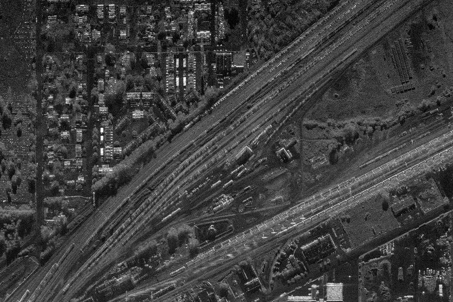
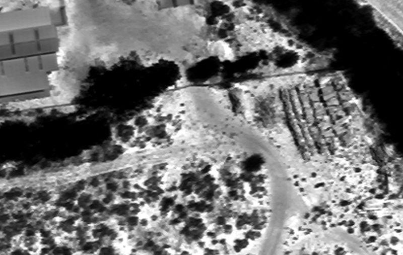
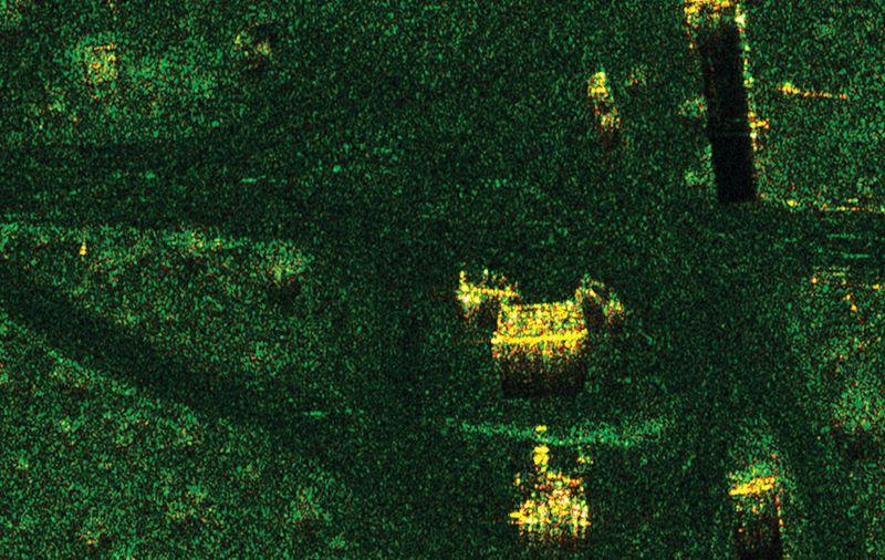
SAR is an all-weather, day or night, imaging system used to generate high-resolution imagery of the ground from an aerial platform.
SYNTHETIC APERTURE RADAR
 LEARN MORE
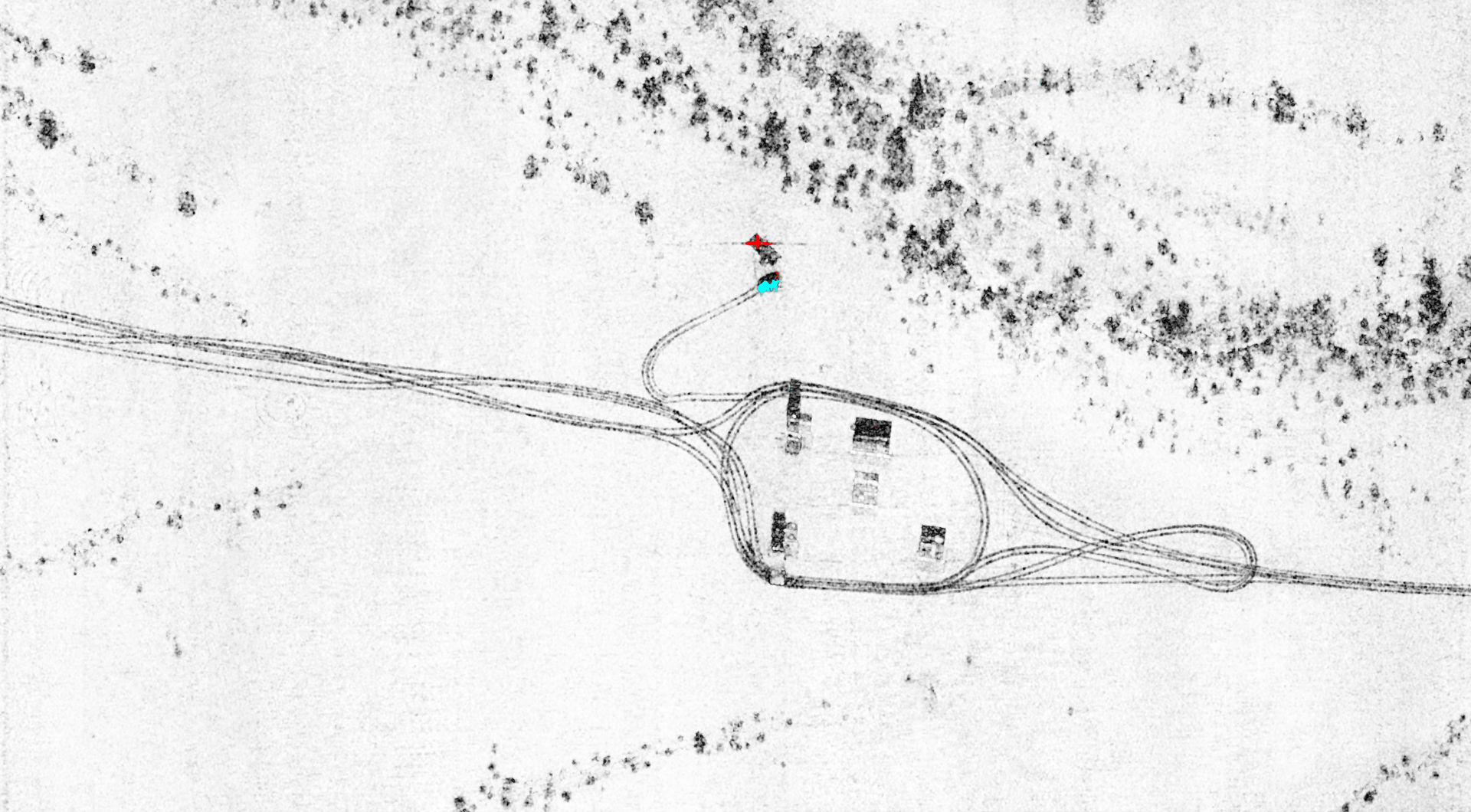
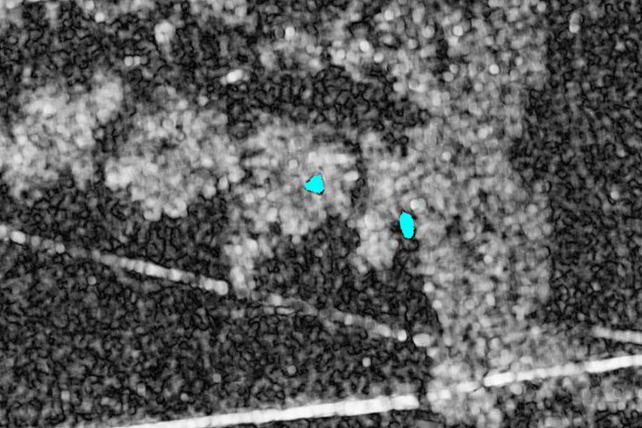
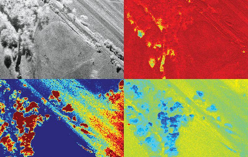
Quickly identify changes in imagery, such as tire tracks or weapons caches, by comparing multiple SAR images.
COHERENT CHANGE DETECTION
 LEARN MORE
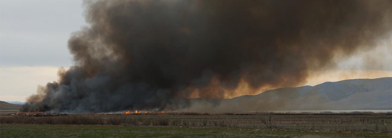
Penetrating radar exploits the advantages of ultra-wide band frequencies to see through foliage and other visual obstructions.
PENETRATING RADAR
 LEARN MORE
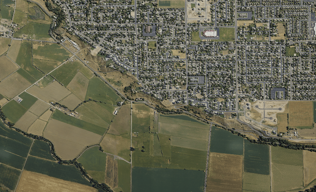
EO imagery is capable of capturing extremely high-resolution photographic stills from high altitudes.
ELECTRO-OPTICAL
 LEARN MORE
IR is capable of detecting infrared radiation and compiling the information into a map of high-resolution thermal detects.
INFRARED
 LEARN MORE
Geospatial mapping uses electro-optical imaging to take orthorectified, photographic imagery and stitches it to form a map.
GEOSPATIAL MAPPING
 LEARN MORE
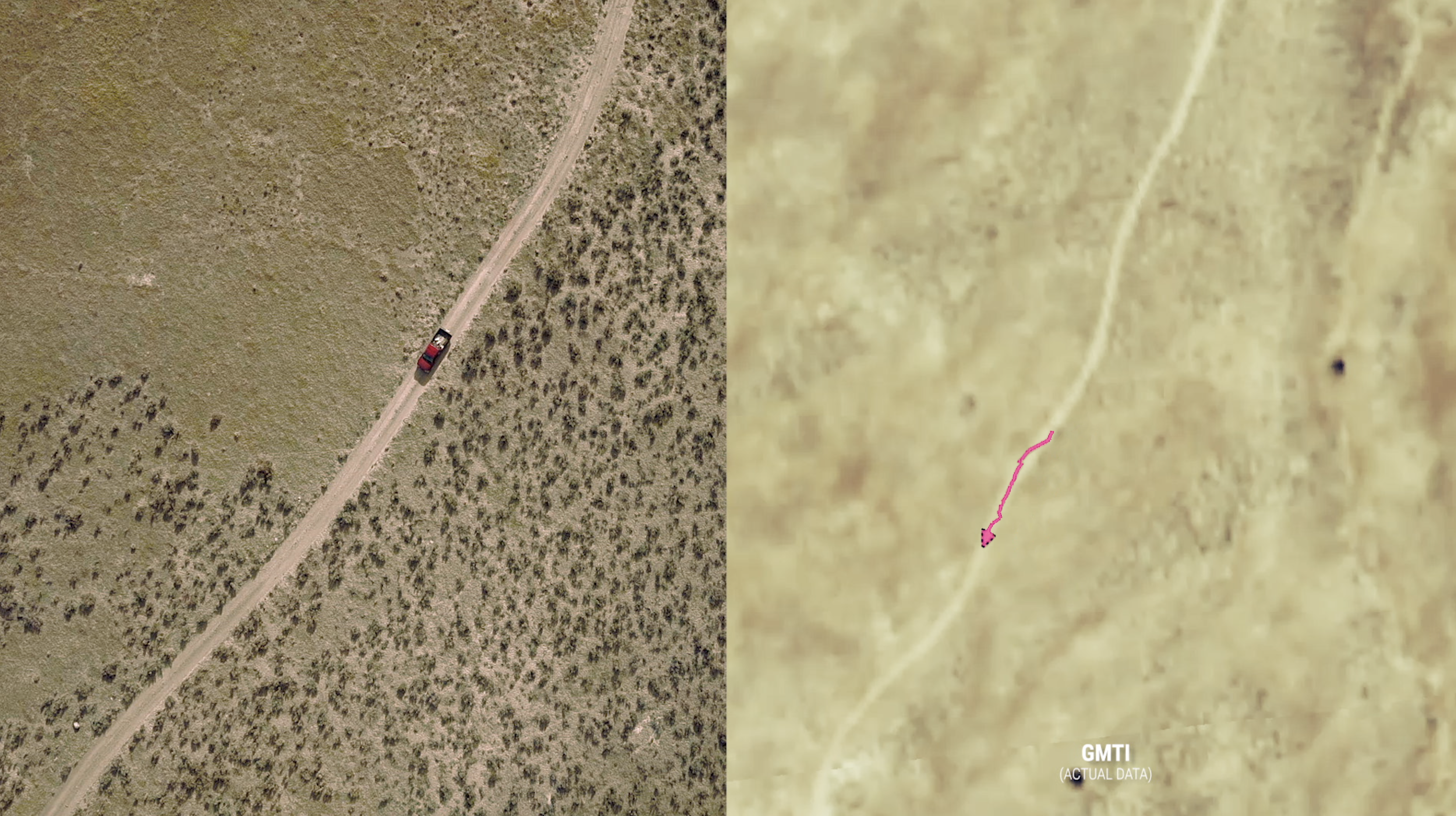
Identify and track dismounts and vehicles over a large area using unique doppler processing.
MOVING TARGET INDICATOR
 LEARN MORE
In all weather and lighting conditions, monitor vast areas of the ocean in search of slow or fast, large or small targets.
MARITIME MONITORING
AREA MONITORING
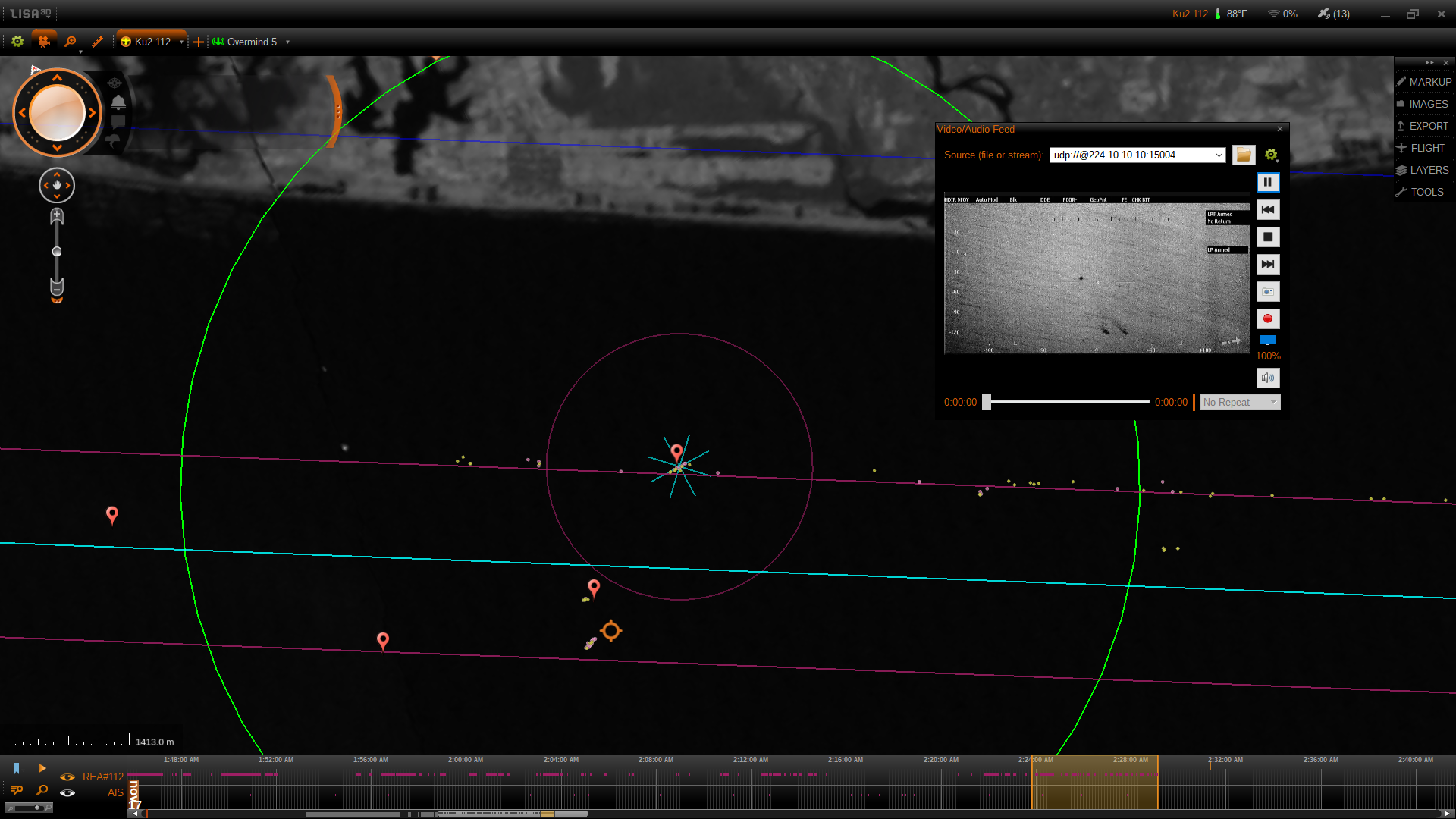
IMSAR monitoring systems provide information on the location of targets within the imaging area. As the targets move, their distance in relation to the passing radar describes the path they have taken. This information allows the radar system to produce data showing the paths that the targets have taken.
EMERGING CAPABILITIES
Every year, technology continues to shrink in size yet grow in capability. World-class imaging radar technology is no different. While being the smallest of its kind, IMSAR systems pack some very powerful capabilities.
 LEARN MORE
DVE is a radar capability designed for visually compromised environments and provide information essential for navigating those environments safely.
DEGRADED VISUAL EVIRONMENT
 LEARN MORE
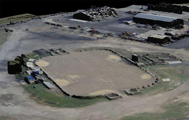
IFSAR transmits and receives signals from multiple antennas to precisely triangulate differences in elevation and create a digital elevation map.
INTERFEROMETRIC SAR
 LEARN MORE
QUAD-POL is SAR imagery using varying polarizations which enable targets to be classified more accurately.
POLARIMETRIC SAR
CAPTURE YOUR VISION WITH IMSAR’S HIGH-RESOLUTION RADAR SYSTEMS.
The more you can see, the more you know; and the more you know, the more you succeed. Let’s put our high-resolution imaging radar with advanced capabilities on your platform.