 DATASHEET
GET LISA 3D
DATASHEET
GET LISA 3D
FULLY INTEGRATED C2 & PED SOFTWARE
LISA 3D
OVERVIEW
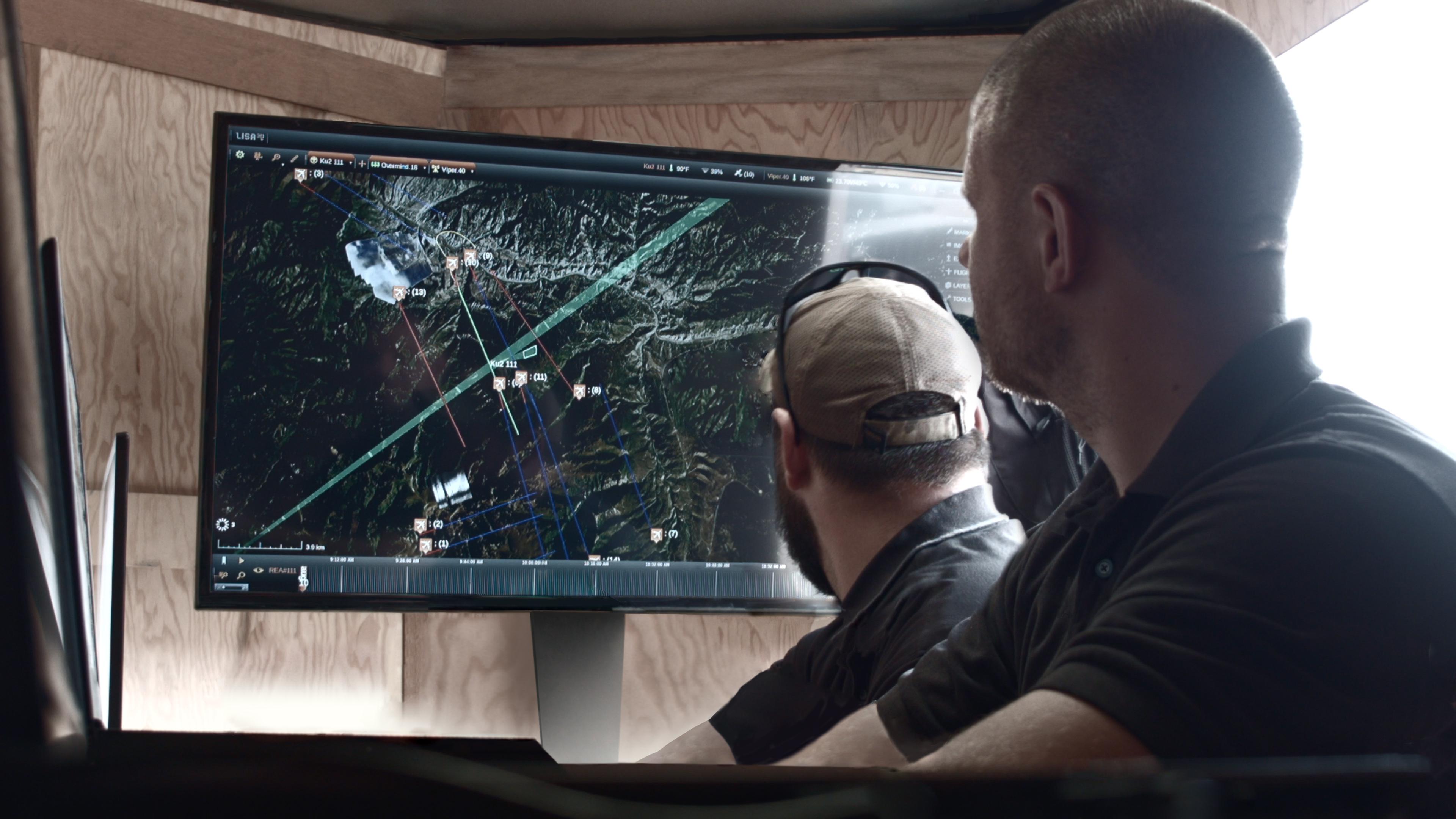
Lisa 3D is a fully integrated, operationally tested software program for mission planning, sensor Command and Control (C2), and the Processing, Exploitation, and Dissemination (PED) of data from multiple sensors simultaneously.

LISA 3D OFFERS THE FOLLOWING FEATURES:
| 1. | Sensor Bar: Monitor and control multiple sensors, servers, and datalinks |
| 2. | Heads-Up Display: Navigate the map and get quick access to important system messages |
| 3. | Flight Plan: Create flight plans for manned and unmanned platforms based off the data collection plan |
| 4. | Asset Tracking: Track the real-time location and field of view of sensors and datalinks |
| 5. | PED Tools: Import and control multiple filetypes, blend layers, make image adjustments, mark up images, and quickly create and export reports |
| 6. | Multi-Sensor Coordination: Program sensors to automatically collect data, dynamically change data collection modes, and cross cue between sensors |
| 7. | Sensor Status: View detailed health information from each item in the sensor bar |
| 8. | Real-Time Data: Ingest and display data in real time from multiple sensors and other sources overlaid on top of a 3D map |
| 9. | Data Collection Plan: Create data collection plans for multiple modes and sensors and see the corresponding flight geometry required |
| 10. | Video Player: Play and record any video streams available on the network |
| 11. | Search: Powerful search tools provide quick access to important data |
| 12. | Timeline: Quickly vie all available data products, select desired data, and click to center map on data |
VIDEO VIGNETTE
SIMPLE TO ANALYZE
Lisa 3D makes analyzing data from multiple sensors simple. In Lisa 3D, sensor data is overlaid on an existing 3D optical map or represented with icons to make data easy to find, see, and understand. Use Lisa 3D to perform real-time analysis of data from multiple sensors and generate actionable intelligence. View, annotate, and mark sensor data. Lisa 3D will automatically highlight annotations and marks on the map, timeline, and calendar. Export data using Lisa 3D’s built-in export feature.

In addition to real-time data analysis, use Lisa 3D to store and search for previously collected data products. Search or filter data by date, date range, time, location, data, or sensor type, and playback data using a variety of playback filters. Run data forensics or training classes using previously collected data.
EXPAND YOUR CAPABILITIES WITH IMSAR’S 7-LB. MULTI-INT SAR/MTI RADAR.
At IMSAR, we believe Intelligence Is Everything, which is why we design and manufacture the most advanced, low-SWaP, all-weather, multi-mode radars. Contact us for further information about our radars’ capabilities and how to integrate onto your platform.