KNOWLEDGE BASE CONTENTS
Knowledge Base / Interpreting & Analyzing Radar Data / Interpreting MTI
3.2 Interpreting MTI
Radar data used to form SAR images can be processed into other products, including MTI. With some basic understanding, MTI products are easy to interpret and enable users to more quickly and effectively advance their missions.
MTI modes provide detections and tracks that indicate the location, direction, and speed of moving targets. Using advanced processing, MTI modes can detect slow-moving targets by extracting data from the surrounding clutter. These indicators enable a user to monitor the activity of several targets over a large area. MTI can be used on land or sea, for a wide range of target sizes including vehicles, dismounts (people), large vessels, and even small targets like fishing boats, RHIBs, and rafts.
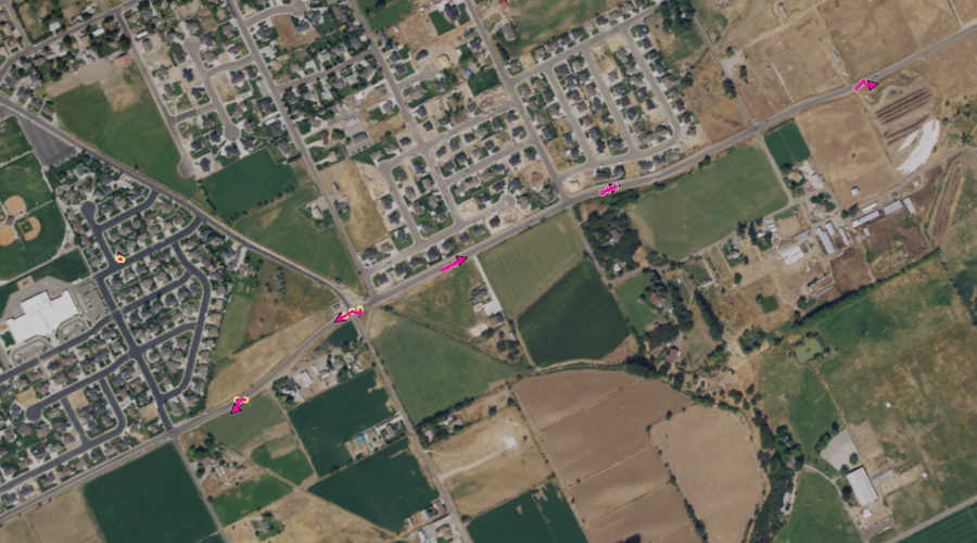
Key:
- Yellow dots: Detected targets moving away from the sensor
- Faded magenta dots: Detected targets moving toward the sensor
- Magenta lines: Estimated tracks of specific targets based on detections
- Magenta arrowheads: Direction of travel of tracked targets
In the screenshot below from a GMTI data collection, several targets have been detected during a circular scan of an area of interest.

Lisa 3D Software Display of GMTI Processing
IMSAR’s MTI modes send out energy in pulses or “chirps” at specifically timed intervals and process the returns to measure the Doppler shift of moving targets. The radar’s processing manipulates the returns to distinguish moving targets from non-moving background clutter. The system then uses complex processing technology to track moving targets and provide the user valuable data about the tracks, including the following information:
- Relative size of targets
- Speed of targets
- Heading and bearing of targets
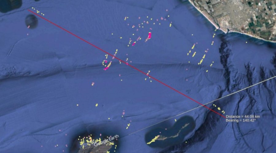
The screenshot below shows detections and tracks from a maritime data collection. The colored markings follow the same interpretation key as for GMTI processing described above.

Lisa 3D Software Display of MMTI Processing from an Open-Water Data Collection
Conclusion
Automated processing of radar data into products reduces the manual processing load of image analysts. To interpret the resulting products, analysts need some basic understanding of the representations displayed on the product. With a little additional training and some understanding of their mission management software, analysts will be equipped to make effective and timely decisions in various CONOP situations.
Contact us at sales@imsar.com for more information.
Related Content
Updated Sept. 24th, 2022
